
As we sail from Santiago to Bartolomé, Javier alerts us to
the presence of dolphins in the water. Our captain slows the
boat, and even circles to make sure we all get to see them. They
swim in a large pod, coming right up to the boat, where we can see
their sleek grey bodies in the water. I admit I was disappointed
that we didn't see them while whale watching the day before, but
now here they are! I am constantly amazed by the richness of
wildlife in the Galápagos, and our luck in seeing so much of it.
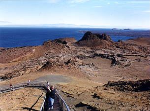
Bartolomé (also known as Bartholomew) is the smallest island in our
visit. It is also perhaps the most photographed. I know that up to
now, I've talked about how obvious the volcanic nature of the islands
is in the landscape, but nothing compares to Bartolomé. It's
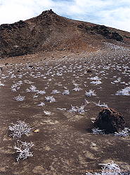
volcanic birth is explosively obvious. Splatter cones and cinder cones
make up what is often referred to as a "moonscape". I think of it
more like Mars, given the red colour. Huge boulders dot the area, once
projectiles of hot lava, their porous nature makes them much lighter
than they look. The ground is almost void of all plant life, except for
small clumps of tiquilia plants that cling to the sand.
Renato gives us a tutorial on the "hot spot" theory of the formation
of islands like the Galápagos, and Hawaii. A hot spot is a concentrated
region of intense heat in the earth's mantle, beneath the plates that
make up the earth's crust. Sometimes, this hot spot burns through the
outer crust and forms a volcano. Sometimes, the pressure
built up from the heat causes an uplift. These plates move over time,
and as they move away from the hot spot, they become less active.
The result is a chain of volcanic islands. In the Galápagos,
the islands to the east are significantly older, with no volcanic
activity. Fernandina and Isabela are still being fed by this hot spot,
with over fifty eruptions in the last 200 years. In 1954, almost
four miles of coastal seabed on Isabela were uplifted about 15 feet,
within a split second. Lobsters, fish and other marine animals were
suddenly beached.
Further evidence has shown that there may have been more islands in
the archipelago, but they have fallen beneath the ocean surface. The
plate that the Galápagos is on slides beneath South America's, so as
the islands move east, they sink. The eastern islands are definately
not as tall as the western ones. As time goes on, the Galápagos we know
today will probably disappear as it moves toward Ecuador at a rate of 7cm
per year, but new islands will form thanks to the hot spot.
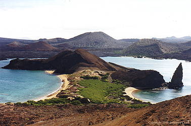
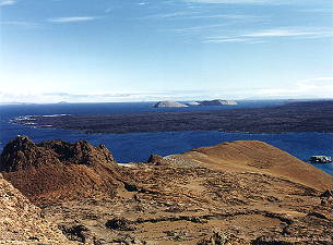
We reach the top of the summit, and the view is phenomenal. On the right,
is Pinnacle Rock, another tuff cone formation like Kicker Rock. On the
left is Sullivan Bay, and before us is Santiago Island. From this vantage
point, we can see several of the smaller central islands like Daphne Mayor
and Daphne Minor, and Sombrero Chino. We pause here in our journey to
think back and marvel at everything we've seen and experienced.

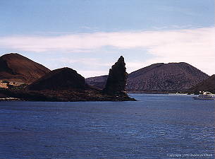
Pinnacle Rock seen from our landing site
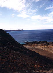
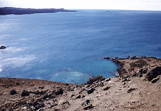
Small submerged volcanic craters
